

")


Submitted by Bill Caulfeild-Browne
Well, warm by November standards – we were almost a degree above the long-term mean. The warmest day was the 8th at 12.9C, the coolest was the 27th at -4.6C. We got our first frost of the season on the 3rd and our first dusting of snow the same day. This was unusually late – we generally see frost in October or even, rarely, in late September.
Then it warmed up again with highs around 10C until we next hit freezing temperatures on the 16th – but recovered until the last week when several daytime highs failed to get above the zero mark. It has been colder inland, away from the lake. This is the time of year when the lakeshore benefits from those still comparatively warm waters.

Most of Ontario had normal or slightly above normal temperatures, the exceptions being in the far north around Hudson’s Bay where they were as much as 4C above normal. This is consistent with the pattern we are seeing so often with climate change – the North is warming faster than the South.
Precipitation was low at 42 mm; the norm is around 70 mm. for my station, or 80 mm. in the 20th century. This was pretty much the case for all of Ontario.
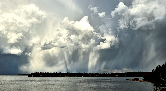
The most dramatic event of the month was a violent thunderstorm that struck Tobermory on the 12th, as can be seen in the attached photograph of its aftermath. It was quite short-lived and very local; winds gusted to 60 kmh and rain amounted to 7 mm – all in a very short time.
December continues the yo-yo of temperatures, up one day, down the next which gives rise to very ice conditions. More on that next month.


