

")
")
")

By Joanne Rodgers,
Bruce Peninsula Press
The Northern Bruce Peninsula saw significant flooding the past few weeks, with numerous property owners reporting flooded basements, submerged driveways and gardens. One Dorcas Bay cottager says it was the most amount of water he has seen lying around, but luckily with no basement, he only had the minor inconvenience of a waterlogged driveway.
Low lying farmland had large pools of water everywhere. Bruce Peninsula National Park informed the public “As of April 14, all trails in the Park are temporarily closed due to flooding and unsafe conditions.” Johnson Harbour Road was also closed due to significant flooding. Cape Hurd Road in Tobermory had water temporarily covering the road.

However, South Bruce Peninsula experienced more damaging floods and declared “a significant weather event on Thursday, April 16, 2026 at 12:44 pm due to forecasted or observed weather conditions. The extreme rainfall events of the last five days, which followed significant snow melt events, has led to significant flooding throughout the Town. Local waterways are exceeding normal spring runoff levels with several watersheds in South Bruce Peninsula experiencing much higher levels than typically seen. The ground is fully saturated with no capacity to absorb additional rainfalls”.
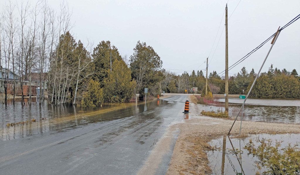
Photo: Cape Hurd Road in Tobermory had water temporarily covering the road.
Photo: Water flows along the trail in Bruce Peninsula National Park.
Several communities on Manitoulin Island declared a state of emergency due to flooded medical facilities, road washouts, water inundated properties and drinking water advisories.
Here in Northern Bruce, by the week of 20 April 2026 , the waterlogged properties were gradually drying out, even though there were large tracts still underwater. Johnson Harbour Road was reopened. The Park has reopened some of their trails but advised the trails were quite wet and muddy.
Community members are advised to exercise caution near water sources and stay off closed trails.


