")
 Emmet")


Submitted by Daryl Cowell & Judy Cowell
The northern Saugeen-Bruce Peninsula is famous for its flowerpot rock structures. Flowerpots are a type of rock stack found throughout the world where water and land meet although ours are unique because of their distinctive shape resembling a garden flowerpot. Other well-known stacks include the “12 Apostles” (now 7) off the west coast of Australia and New Brunswick’s famous “Picture Rocks”.
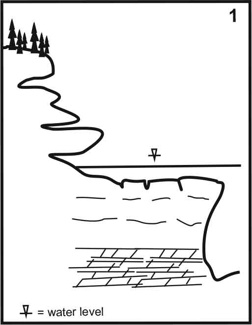
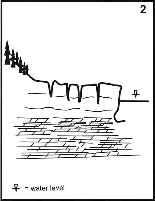
Flowerpots are created from wave erosion of the dolostone bedrock created during declining glacial lake and postglacial lake water levels. The most critical control on the shape of these stacks is the presence of thick bedrock beds overlying thinner bedrock beds. It is not a function of harder rocks over softer rocks: all the beds are equal in hardness.

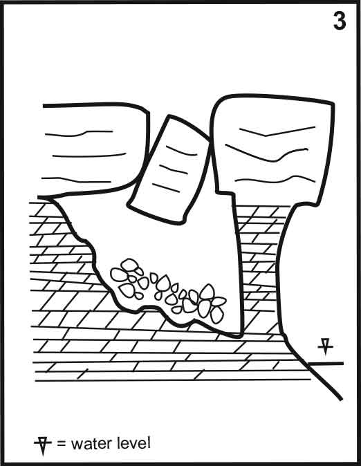
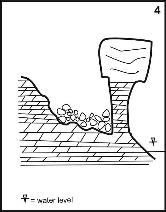
The ultimate development of the features is the creation of a rock pillar completely isolated from the rock face. Length of time and erosive strength varies from location to location and thus we find many ‘incipient’ stacks where the process was active but the stack could not be completely separated from the cliff face. Continued wave action at or near the base of the stack will eventually topple it; the “boulder” on top of Boulder Bluff at Cabot Head is likely the best example.
The stages of flowerpot stack structure formation are illustrated below.
Editor’s Note: Daryl W. Cowell, B.A., M.Sc., P.Geo., is a retired environmental geologist and karst specialist who has worked across Canada and internationally. A Tobermory resident since 2002, he has contributed to environmental research, land management, scientific publications, and public education, including co-authoring a book on Bruce-Grey geology.


